


Video: Inside ATFP Gala 2013
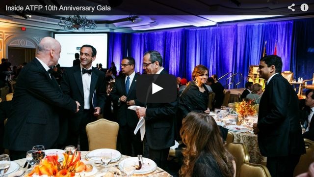
Photo Gallery: ATFP Gala 2013


Center for American Progress - Middle East Bulletin - April 29, 2010 - Back to Resources Page

Center for American Progress - Middle East Bulletin - April 29, 2010 - Back to Resources Page
»
April 29, 2010
Israeli proposal at Annapolis talks (Dan Rothem)
To see full-sized maps prepared by Dan Rothem click on images.
The United States is working to launch proximity talks between Israelis and Palestinians, and one of the main issues will be borders. What are the territorial compromises that are possible from both sides in order to reconcile Israel’s need for security with the Palestinian aspiration for statehood?
The stated U.S. formula creates a sort of a equation between the ‘Palestinian goal of an independent and viable state, based on the 1967 lines, with agreed swaps’ on the one hand, and the ‘Israeli goal of a Jewish state with secure and recognized borders that reflect subsequent developments and meet Israeli security requirements’ on the other hand. If you take this formula, and combine it with the mechanism of proximity talks, I think the American side could quickly find itself in a very important role. It will sit with Israeli representatives and talk about Israel’s security needs in the context of Palestinian sovereignty, independence and viability, and then turn and sit with the Palestinians and talk about their border needs in the context of modifications to the 1967 lines. It can then guide the discussion, interjecting its own interpretation and insights. All of this, of course, assumes that proximity talks start and that they will surround at least these two core issues of borders and security, which may or may not be the case.
You asked about borders, but I do think that since it’s equated with security one thing here is important to mention: in the context of the prospective security discussions between Israel and the United States, we won’t be starting from scratch. The recent experience of now U.S. National Security Advisor James Jones, overseeing a comprehensive regional security evaluation during the last year or so of the Bush administration, would be extremely important in quickly getting this matter to a productive phase.
As for borders, I think the U.S. formula pretty much spells it out: the borders will be based on the 1967 lines with agreed swaps—meaning 1:1 swaps, since it’s unlikely that the Palestinians will agree to anything short of equal swaps—that will reflect ‘subsequent developments’—meaning that some of the largest settlement blocks housing the majority of the settlers will be annexed to Israel in the context of these swaps.
What are the most contested areas of disagreement and how can the parties’ different approaches be bridged?
The formula we mentioned means Israel will have to take a step forward from where it has been willing to go thus far—meaning accepting border modifications on an equal swap basis. Since Israel does not have unlimited land to offer in the context of equal swaps, this 1:1 principle in and of itself will limit the size of Israeli annexation. In real terms, this may mean Israel will not get all of the largest settlement areas it has consistently asked for: Greater Jerusalem (E-1, Ma’ale Adumim, Giv’at Ze’ev, and Har Homa), Qarnei Shomron, Ariel, the Ezion Block, and Efrat. Of these areas, Ariel is the one deepest into the West Bank.
As for the Palestinians, while I acknowledge their willingness to accept modifications to the 1967 lines, which is a step beyond the historic international position on borders and the Arab Peace Initiative’s phrasing on the matter, I think they will need to allow for swaps larger than what they have agreed to before, especially in the Greater Jerusalem area. I also think that they will need to be more forthcoming than before on the question of security arrangements that will meet real Israeli needs.
How do Israeli settlements in the West Bank fit into the picture? What are the alternatives in terms of the number of settlers who would have to be evacuated? What would be the different implications of these alternatives?
There are roughly 500,000 Jewish Israelis that reside east of the 1967 lines; of them, about 200,000 are in East Jerusalem and the other 300,000 in the West Bank proper. Luckily for those of us who want to see an agreement on permanent borders and an end to this conflict, most of these settlers reside very close to the 1967 lines. This means that if we take into account today’s settler demographics, a likely agreement would leave between 70,000-130,000 settlers on the Palestinian side of the border, depending on how you draw the line.
Now comes the question of what to do with them. By far the most accepted notion is that they will need to be evacuated, and I believe most will do so willingly in the context of a peace agreement that includes compensation packages. There are other proposals that will allow settlers to stay under Palestinian sovereignty if they choose to do so, but I have not seen a meaningful shift in the Palestinian position toward such an arrangement beyond sporadic half-statements.
The media has widely discussed the map former PM Ehud Olmert allegedly presented to Palestinian President Mahmoud Abbas. Can you elaborate on the specifics of this map and what the points of disagreement were between the two?
Haaretz published its understanding of Prime Minister Olmert’s borders proposal to the Palestinians. The map pretty much reflects what Olmert himself described in various places as his territorial offer: annexation of the large settlement blocks, which would be 6.0-6.5 percent (depending on how you count percentages; there is not one defined methodology to do so), and a swap of around 5.2-5.8 percent (again, depending on how you count percentages), some of which is around the Gaza Strip, some in the Jordan Valley south of Beit She’an, and the majority in the Judean Desert. It is noteworthy to say that while this proposal did not go as far as some civil society models like the Geneva Initiative’s map, it has been the most generous official proposal by an Israeli prime minister—more than the January 2001 Taba negotiations and certainly more than the July 2000 Camp David negotiations.
Interestingly, and I must admit I’m a little disappointed that the press did not reflect this more clearly, the Palestinians offered their own map in the context of the Annapolis process. A good interpretation of this map, although without representation of swaps, appears on page 65 of the recent Baker Institute report on borders.


In preparation for this interview, I’ve created two maps illustrating the two proposals with my own interpretation of what they looked like (with swaps and the division of Jerusalem along demographic lines) and what they mean in terms geographic and demographic numbers.
So, if the United States were able to get the sides rather quickly to the ‘point where they left off’ —to which they have not been able to secure an Israeli agreement—I think we all can imagine the spectrum of possible agreements. Those of your readers that can’t wait and want to play around with possible solutions interactively, can find it on the maps and borders section of the S. Daniel Abraham Center for Middle East Peace website.
How do attempts to formulate territorial solution address the need for safe passage for both Palestinians and Israelis through each other’s sovereign territories?
So far, an accepted notion of a permanent status agreement envisioned a Palestinian corridor linking the West Bank with the Gaza Strip. Unlike a ‘safe passage’—a term employed in the Oslo B agreement—which envisioned Palestinian movement through existing Israeli infrastructure, a corridor will likely consist of newly-created infrastructure: roughly 100-200 meters in width, including a road, a railway, and means for running other infrastructure such as pipes and cables, at the sole administration of Palestinians, although probably not under Palestinian sovereignty.
In the eyes of Israeli leaders, since a Gaza-West Bank link did not exist prior to 1967, its introduction should come at the expense of equal swaps. Some point to the 2000 Clinton parameters, which did not embrace the equal territory principle and treated such a link, as well as the use of other Israeli infrastructure such as sea and air ports, as equalizers. But I think ultimately land swaps would be equal, and that Israel can and should demand use of roads in Palestine, such as the arrangements envisioned in the ‘Designated Roads’ annex of the Geneva Initiative.
You mentioned the recent James Baker Institute’s report on the territorial endgame, which, presented five optional maps. What is your take on their proposals?
Generally speaking, the Baker report is a worthy exercise that instantly became a must-read for all who are involved in the territorial dimension of the conflict and the attempt to resolve it. It is the first time, I believe, when people at the level of Ambassador Ed Djerejian and perhaps even Secretary Baker himself dove into such fine detail as to identifying all relevant settlements by name, attributing values to them, and dealing with the nitty-gritty stuff that makes agreement on borders possible.
But, aside from getting important people familiar with where the settlement of Sal’it is, there are important lessons for the actual negotiations from this exercise, especially in relation to the role of the third party. I won’t go into details here, but I will say that the report demonstrates clearly that the American side will need to bring to the table unprecedented expertise and knowledge in the Israeli-Palestinian negotiations over the core issues.
I think this point is a critical one: Since 1993, the American efforts have consistently focused on getting the sides to what Secretary Clinton recently phrased as ‘good faith negotiations.’ And while it’s clear to everybody that the likelihood of ‘good faith’ here is not high, it still seems that the American diplomatic DNA is geared toward getting the sides to the table, and watching them somehow, someway, hammer out their differences.
Now, if you ask American officials they will disagree, describing long periods of robust American shuttling between the sides, confronting them on all sorts of issues, and providing American expertise and inputs. My assertion is that all of this is 100 percent accurate when it relates to interim agreements or other measures, but when it comes to the core issues of borders, Jerusalem, and refugees, the United States has historically taken a rather passive role, with the December 2000 Clinton parameters being the exception. I believe that if the United States indeed wants to see an agreement, and not just the resumption of negotiations, it will have to take on a very assertive role in identifying solutions to the three core issues.
Haaretz reported last week that Prime Minister Benjamin Netanyahu is “amenable to an interim agreement in the West Bank that would include the establishment of a Palestinian state within temporary borders.” How might such a state look and is this suggestion technically feasible?
A Palestinian state with provisional borders is not a new idea by any means. Indeed, it is the optional second phase of the 2003 road map. Its most recent manifestation was in a plan proposed by Kadima MK Shaul Mofaz, in which he delineated a Palestinian state in the Gaza Strip and in roughly 60 percent of the West Bank. Palestinians consistently reject this idea, fearing the provisional will become permanent.
There were a few attempts at putting pen to paper on this concept, including a 2003 report by Khalil Shikaki, but all seem to follow some basic guidelines: Israeli control over East Jerusalem, all of the large settlement areas, additional fingers to include some—although not all—isolated settlements, and control over the Jordan Valley.
Construction in East Jerusalem has featured in the news in the last few weeks. Although it is a separate core issue in the dispute, can Jerusalem be discussed separately from the larger question of borders? How might a solution in Jerusalem look? How will it affect the demographic balance of the city?
The Old City of Jerusalem between the walls (or alternatively the Historic Basin, if the sides can agree to its delineation) is around 1 sq. km in area. It’s reasonable to expect the sides to work under the assumption that special treatment including robust international presence would be introduced there. As to the expanded area of Jerusalem, as marked by its current municipal boundary, there is nothing holy about it and borders can and should be demarcated there—the accepted notion being that the border there would be based on demographic realities: Jewish neighborhoods will come under Israeli sovereignty and Arab ones under Palestinian sovereignty.
This has also security implications. My assumption is that a day after an agreement is reached, Israel will—and should—erect a physical barrier on these borders. Leaving the Jerusalem municipal area out of the borders equation would leave a huge gap in Israel’s ability to physically separate itself from the Palestinians.
Demographically, transferring the Arab neighborhoods of Jerusalem to Palestinian sovereignty makes a lot of sense from an Israeli perspective. There are roughly 260,000 Palestinian East Jerusalemites who see themselves as an integral part of the Palestinian people and the Palestinian nation. In the vast majority of cases, Israeli sovereignty in the Palestinian neighborhoods is fiction, and the disparity between Jewish areas of Jerusalem and Palestinian areas is staggering. So if you look beyond the myth of ‘unified, never to be divided’ Jerusalem under Israeli control, it’s pretty clear that two separate capitals will exist there—one Israeli and one Palestinian.
How would a likely agreement on borders affect the route of the separation barrier?
 I don’t mean to neglect the harsh humanitarian implication of the barrier on those who live close to it, but if you look at a map representing the status of the barrier’s construction, you can see that the constructed parts are largely along or close to the 1967 lines (with the notable exception of Jerusalem), and the large blocks are mostly stuck in various planning phases. This has many reasons and I won’t go into them here, but I will say that once an agreement is reached, Israel will build a barrier along that agreed border which in effect will mean one continuous barrier, including new construction around the settlement blocks and the rerouting of barrier parts where land swaps will be introduced.
In the event that negotiations start over between Israel and Syria, what can be expected in terms of territorial compromise in the north?
I think the concept of ‘full withdrawal’ from the Golan Heights is the accepted notion of the Israeli-Syrian borders component and has been since Rabin’s ‘deposit’ to Secretary Warren Christopher. It was reaffirmed in many different ways by all subsequent Israeli prime ministers—including Netanyahu in his first term, during discussions with then Syrian President Hafez al-Assad via American businessman Ronald Lauder—apart from Ariel Sharon.
The technical question is full withdrawal to where? In the past, Israelis based their understanding of potential withdrawal on the 1923 international boundary that ran purposefully and consistently—although sometimes just symbolically—east of the major water resources and specifically the upper Jordan River and the Kinneret [Sea of Galilee]. The Syrians insisted that withdrawal will take place to a June 4, 1967 line, which—in all honesty—they never presented and that does not exist on any official historical map.
The only relevant historical line apart from the 1923 international boundary is the 1949 Israel-Syria Armistice Demarcation Line, which in some areas ran along the international boundary and in others—apart from one small exception—ran west of it (where Syrian forces were at the end of the 1948-1949 war). Where the 1923 and 1949 lines did not overlap, demilitarized zones [DMZs] were marked. The problem is that this situation existed only on maps. In real life both sides, based on different interpretations of the status of the DMZs and on other interests, exercised incursion and de facto control over parts of the DMZs, and a difficult-to-define reality existed on the eve of the 1967 war. One significant attempt to mark a June 1967 line was made by now Mitchell team member Fred Hof and is referenced in his 2009 USIP report.
In any case, it’s important to understand that for all practical purposes, regardless whether the borderline will be the international boundary line, Fred Hof’s interpretation of the 1967 line or a new line agreed by the parties—adequate arrangements will need to be agreed on for security and demilitarization, water treatment, environmental issues, cross-border access and other normalization issues.
However, I think the real problem here is the complexity of the regional arena. In 1999-2000, when most of the headway was made on the Israeli-Syrian negotiations, it was assumed, and I’m simplifying here, that if agreement was reached, Syria would minimize if not eliminate the military threat posed by Hezbollah in Lebanon, and that Israel would ‘deliver’ for Syria robust economic relationship with the West, primarily the United States. I think the situation now is much more complex—Syria, which officially withdrew from Lebanon in 2005, is but one of many factors that influence Hezbollah, and the U.S.-Syrian bilateral relationship has multiple factors that did not exist in 2000, primarily the U.S. presence in Iraq and Syrian policy there. And I’m not even starting to talk about Syria’s willingness or unwillingness strategically to realign away from Iran, which may be the fundamental issue in the eyes of Israel and the Western parties.
How would such a border affect the status of the Shabaa Farms?
Once an agreement is reached on an Israeli-Syrian border, the Shabaa farms would become a Syrian-Lebanese issue to be settled in their bilateral borders demarcation process.
Center for American Progress - Middle East Bulletin - April 29, 2010 - Back to Resources Page
»
Did we miss something?
Click here to suggest a state building resource to be added to our fast-growing archive!
Recent News

.@ZiadAsali: By focusing on transition phase, good governance must top agenda to build Palestinian infrastructure
https://t.co/fL2mlkG4Y5
8 years 27 weeks ago
|
In @TheNatlInterest ATFP Pres. @ZiadAsali asks if the two-state solution still exists?
https://t.co/fL2mlkG4Y5
8 years 27 weeks ago
|
RT @Ibishblog: This is sober and correct https://t.co/217oW6j5eC
8 years 28 weeks ago
|
American Task Force on Palestine - 1634 Eye St. NW, Suite 725, Washington DC 20006 - Telephone: 202-262-0017